Whitetail Deer by Region: What the Science Says About Why Texas Bucks Aren't All Built the Same

.webp)
Ask any Texas hunter and they'll tell you a Hill Country buck doesn't look like a South Texas buck, and a Pineywoods deer doesn't look like either one. That's not folklore, it's backed by soil maps, ecoregion boundaries, and peer-reviewed research. One of the more surprising findings in recent years is that deer size doesn't just vary state to state. It can vary significantly within a single region, over distances of only a few dozen miles.
Texas's Ecoregions, in Brief
The EPA and Texas Parks and Wildlife divide the state into distinct ecoregions based on soil, geology, climate, and vegetation. That same framework is used by wildlife biologists to explain why deer, and the habitat that supports them, differ so much across the state. At the broadest level, Texas contains regions ranging from the pine and hardwood forests of the Pineywoods in the east, to the clay-soil prairies of the Blackland Prairie and Cross Timbers in north-central Texas, to the limestone hills of the Edwards Plateau, the thornscrub brushlands of the South Texas Plains, the shortgrass High Plains of the Panhandle, and the arid, mountainous Trans-Pecos in the far west. Each region with its own soil chemistry, rainfall, and native forage base.
These factors matter for whitetail because of the vegetation composition on a piece of land. Body size and antler development follow soil and ecoregion boundaries almost as closely as the vegetation itself.
The Surprising Part: Size Varies Even Within South Texas
A 2023 study published in Rangeland Ecology & Management put this to the test directly in South Texas. In ground zero for trophy whitetail management, researchers captured and measured deer at four sites spanning the Coastal Sand Plain and Tamaulipan Thornscrub ecoregions to see how much body size and antler size changed over relatively short distances, and why.
The results were striking. Female deer near the eastern edge of the Coastal Sand Plain weighed over 3 kg less on average than females from the western transition zone and interior Tamaulipan Thornscrub sites. Male deer showed even bigger gaps: bodies over 6 kg lighter and antlers more than 20 cm smaller in the coastal habitat compared with interior sites, all within South Texas, not across the state. To find out why, the researchers measured all things forage-related at each site. Plant biomass, browse diversity, digestible energy, protein, phosphorus, fiber content were all assessed. The sites' habitat did differ, but those differences didn't line up with which deer were bigger. The forage data couldn't account for the size gap on its own, meaning the real answer isn't simply "richer ground grows bigger deer." Genetics, population density, and other factors are clearly part of the equation.
What This Means If You Manage Land in More Than One Spot
Two things follow from this research, and both matter for how you plan a survey or a harvest strategy:
Regional averages can mislead you at the property level. If your ranch sits near an ecoregion boundary, for example where the Tamaulipan Thornscrub transitions into the Coastal Sand Plain, or where the Edwards Plateau grades into the Cross Timbers, "typical South Texas" or "typical Hill Country" numbers may not describe your herd accurately. The Rankins et al. data shows meaningful size differences over distances short enough that two ranches in the "same" region can look quite different.
Forage alone won't tell you the whole story. Habitat and nutrition work matters, but this study is a reminder that body size and antler development respond to more than what's growing on the ground in a given year. Density, genetics, and herd structure all factor into whitetail herd composition, which is exactly why an accurate population count, not just a habitat assessment, is central to sound wildlife management.
This Is a Survey Question, Not Just a Habitat Question
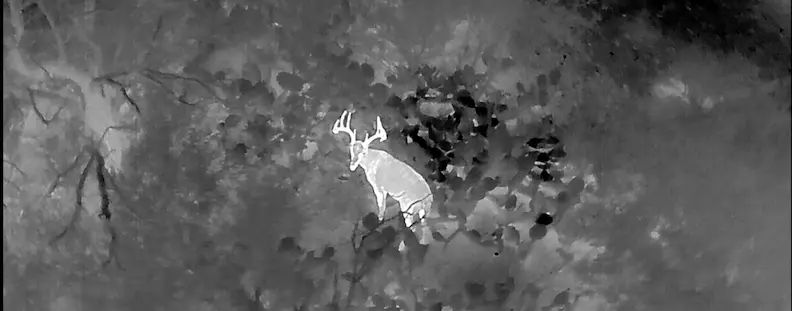
Because size and herd characteristics can shift meaningfully even within a single ecoregion, the only reliable way to know what your property is actually producing is documentation. Extrapolating from a neighboring ranch or a regional average may not accurately give you insight into your property. A thermal drone survey gives you your property's real density, buck:doe ratio, and age structure, which is the foundation for setting harvest recommendations that fit your land, not the region it happens to sit in.
Curious how your property's herd compares to what the research would predict? Request a quote from Sky Senderos and find out.
Sources: Rankins, S.T., et al. 2023. "Ecogeographic Variation in Physical Traits of White-Tailed Deer." Rangeland Ecology & Management 87:185–197. · Griffith, G.E., et al. 2004. "Ecoregions of Texas" (EPA/TCEQ).
.webp)
.webp)