What Affects the Accuracy of Thermal Drone Wildlife Surveys?

At Sky Senderos, we’re often asked: “Will a thermal drone find every single animal on my property?”
The honest answer? No, it won’t, and any survey provider who tells you otherwise should be avoided.
When considering a thermal drone wildlife survey for your property, it's important to have realistic expectations. While thermal imaging technology allows us to see many things invisible to the human eye, it's not x-ray vision. A thermal drone survey won't identify every game animal on your ranch, but it will almost always be your most effective game count method.
The truth is, counting wild animals isn't an exact science. That's why it's called a survey: we're working to get a representative view of your property's wildlife population. The level of accuracy varies from property to property, depending on several key factors we've identified through flying more properties across Texas than any other drone provider. Let’s break down what makes a survey successful and what can impact the results.
Flight Conditions: Timing Is Everything
Heat
Heat is probably the most crucial factor, but not in the way most people think. It’s not the ambient air temperature that matters most, but rather the temperature difference between animals and their surroundings. We learned this lesson dramatically during the big freeze of 2025 when temperatures dropped to single digits. Counterintuitively, these conditions were actually worse than flying in the South Texas summer heat. The sun-warmed trees and rocks glowed significantly hotter compared to the cold ground, creating bright heat signatures that made it especially difficult to distinguish animals from their surroundings.
Cloud Cover
The most ideal conditions for thermal surveys? Cloudy days. When clouds block direct sunlight, ground temperatures and surrounding features equilibrate, creating optimal contrast for identifying wildlife heat signatures. This uniform temperature environment makes animals stand out clearly against the background.
Wind and Rain
Heavy wind and rain don't just ground our drones, they also change animal behavior. In these conditions, wildlife beds down deep within brush to escape the elements. When animals hunker down like this, even our advanced thermal cameras are more likely to miss them, reducing survey accuracy.
Fog
Low-hanging fog presents a unique weather-related challenge for thermal surveys. Not only does it make thermal imagery somewhat blurry by scattering the infrared radiation we rely on for clear images, but it also causes a practical problem: water droplets accumulating on our drone cameras. This moisture buildup can significantly degrade image quality or even make accurate surveying impossible. When fog is present, we may need to postpone flights until conditions clear to ensure you get the sharp, accurate thermal imagery needed for a reliable wildlife count.
Time of Day
Night flights are optimal for thermal surveys because the sun isn't actively heating during these hours. Without solar radiation creating hot spots on rocks, trees, and vegetation, animal heat signatures stand out clearly against the cooler background. This creates the high contrast we need for accurate counting.
Early morning flights are possible when clients need visible light camera footage alongside thermal imaging. However, it forces us to work against a tight deadline as we typically have only 2-3 hours after first light before the sun begins heating surfaces and degrading thermal contrast. Once the sun climbs higher and starts warming the landscape, distinguishing animals from their surroundings becomes increasingly difficult.
Property Characteristics: Know Your Terrain
Vegetation: The Number One Factor
Different regions of Texas present unique challenges based on their native (and invasive) vegetation:
South Texas
Even in areas with thick brush, if it's low-growing, our thermal cameras can often see through fairly well. However, the oak belt presents more challenges due to canopy coverage. For properties in these areas, we recommend taking advantage of post-season counts when leaves have fallen to achieve more accurate numbers. Prickly pear cactus add another variable as their water-rich tissues can glow intensely after rain, and they retain heat after sunny days, creating false heat signatures that often are the size of deer.
West Texas and Hill Country
Cedar (juniper) presents perhaps our biggest vegetation challenge. Animals can remain completely invisible beneath its dense canopy that struggles to dissipate heat overnight. Unlike deciduous trees, cedar never defoliates, so winter flights don't necessarily provide the seasonal advantage we see in other regions.
North Texas
The mixed terrain of North Texas presents moderate challenges for thermal surveys. Properties here typically feature a combination of open grasslands and wooded areas with oak, mesquite, and hackberry trees. While the canopy coverage is generally less dense than East Texas pines, the scattered tree cover can still obscure animals, particularly during summer months when foliage is full. Winter surveys tend to be more effective after leaf drop, and the typically flatter terrain makes flight planning more straightforward than in hillier regions.
East Texas
Pine forests make thermal surveys particularly challenging. The dense evergreen canopy can completely obscure animals below. However, if your property has undergone extensive burning and brush management, winter surveys can be quite effective when understory vegetation is at its minimum.
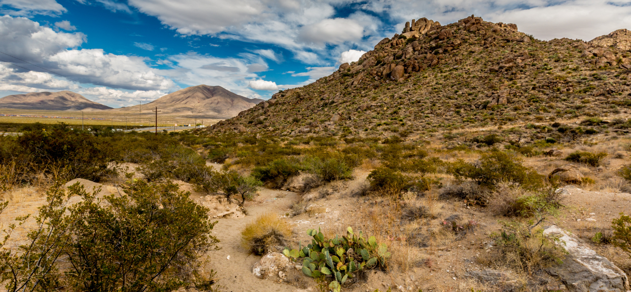
Rocky Terrain: A Summer Challenge
Rocky properties, particularly common in West Texas, create unique difficulties for summer surveys. Rocks absorb heat throughout the day and retain it well into the night. Even flights starting at two or three in the morning can struggle with heat-saturated stone creating a bright thermal background. Our recommendation? Schedule these surveys for winter months or cloudy days when rocks can't accumulate solar heat.
Setting Realistic Expectations
Here's what you need to know: thermal drone surveys will always provide a more accurate count than traditional helicopter surveys. On any property, thermal technology allows us to see more wildlife than human observers alone ever could. However, the effectiveness of your survey depends heavily on your property's characteristics and the conditions during flight.
What counts as "thick foliage" or "rocky terrain" varies from person to person. That's why Sky Senderos offers to review aerial images of your property before scheduling a survey. Having flown more properties in more locations across Texas than any other drone provider, we can give you an informed recommendation about the optimal timing for your survey based on comparable properties we've flown in your area.
Ready to Schedule Your Survey?
Understanding these factors helps you plan for the most accurate wildlife survey possible. Whether you're managing for hunting, conservation, or property valuation, getting an accurate count starts with choosing the right conditions for your unique property.
Contact Sky Senderos to discuss your property's characteristics and schedule your thermal drone survey when conditions will deliver the best results. We're happy to review your property's aerial imagery and provide personalized recommendations for maximizing your survey accuracy. Request your free quote today!
.webp)
.webp)
.webp)